Procedural terrain with biomes, resources, and terrain variation.
World Generation
ED5 can procedurally generate entire continents at the click of a button — or you can manually paint every tile. Most creators use a mix of both: generate a base world, then hand-edit the important areas.
How Generation Works
The generator uses layered noise algorithms to create natural-looking terrain:
1. Elevation — determines water vs land, mountains vs valleys 2. Moisture — wet vs dry areas 3. Temperature — cold vs hot regions 4. Continentalness — island and continent shapes
These layers combine to assign a biome to every tile — but only once you have told the map which biomes it is made of. See below.
Choosing What a Map Is Made Of
Open a map, then World Gen → Terrain Shape. Two controls decide its biomes:
| Control | What it does |
|---|---|
| Biome | The single biome the whole map is made of. Every map has one, and it is what generates unless you mix. |
| Water biome | What the sea and lakes are made of. Leave it on Match the biome and a built-in biome uses its usual partner — a biome you created has none, so it falls back to Ocean and needs Ocean to have art. |
| Mix several biomes | Tick two or more and the map becomes multi-biome: every land tile is classified against the elevation, moisture and temperature ranges you set on each biome. Leave them all unticked for a single-biome map. |
Both lists show only your biomes, and mark any that have no floor tileset — a biome with no ground art generates tiles that render as nothing, so it is worth seeing before you pick it rather than after.
> A map remembers its choice. It is saved on the map, not on the generation, so it survives a reload and a regeneration.
> Mixing needs ranges that differ. Biomes left on the default ranges all describe the same climate, so mixing several of them gives an arbitrary pick between identical candidates. Give each one a band of its own — that is what makes the mountains land on the mountains.
> Nothing matches? Nothing is skipped. A tile whose climate no biome covers is given the closest one, so a map never has holes where the generator found no biome.
Biomes Are Yours to Define
Biomes are authored content, not a fixed list. Every biome is a row you can edit, add to, or delete in the biome editor, and the generator reads your rows — so a sci-fi world can ship with Ash Flats and Crystal Fields and no forests at all.
Each biome defines:
| Field | What it controls |
|---|---|
| Id / name / color | Its identity, and how it reads on the minimap and in the editor |
| Tile palette | The tilesets this biome is drawn with — see below. Without one the generator falls back to the first tileset tagged with the biome |
| Elevation range | The heights it appears at, water level up to mountain peaks. Read when the map mixes several biomes |
| Moisture range | How wet the terrain must be. Same — only consulted on a mixed map |
| Temperature range | How hot or cold. Same |
| Walkable | Whether players can enter it at all |
| Tile variants | How many tile variations break up the texture |
| Prop density + prop pool | What this biome scatters, and how thickly. World Gen → Vegetation & Objects → Object Density scales every biome at once, so zero there clears the map without editing any of them |
| Ambient sound / music | What the biome sounds like |
| Glow config | Optional light emission (color, intensity, radius, flicker) for lava, fungus, magic |
The generator picks a biome per tile by matching the elevation, moisture and temperature it rolled against those ranges — so adding a biome is a matter of claiming a slice of that space, and deleting one hands its slice to its neighbours.
Choosing what a biome is drawn with
A biome's Tile palette is what the generator paints it with. Open Biomes → the biome → Tile palette and add tilesets under three headings:
| Role | What it paints |
|---|---|
| Ground — autotiles | Used when you generate in Autotile style. Crisp tile edges, resolved against neighbouring tiles |
| Ground — blended | Used when you generate in Blended style. Neighbouring terrains melt into each other. Only offers the blend-capable terrains |
| Overlay | Laid over the ground on part of the tiles. Its coverage slider decides how much of the biome gets it — 25% scatters wildflowers, 100% blankets the biome |
| Cliff & wall | The vertical face drawn wherever the ground steps up or down |
Each list only offers tilesets that suit its role, so a cliff sheet can't end up painting a meadow — and the blended list only offers terrains the blend compositor can actually work with.
Autotiles or blended — pick one per map
Ground style lives in the generator (right-click a map → Generate Map), not on the biome, because it applies to the whole map:
| Style | What it looks like |
|---|---|
| Autotiles | Crisp tile edges. Each ground fills contiguous regions and resolves its borders with the tileset's own edge pieces. The classic tile-based look |
| Blended | Terrains melt into each other. A river fades into its banks instead of meeting them at a step. The painterly look |
It is one choice per map rather than per biome for a reason: a map whose land is blended and whose water is an autotile puts a hard, stair-stepped shoreline against organic ground — two drawing systems meeting in the middle of one map. Setting it once makes that impossible.
Before it generates, the editor checks every biome the map will use and refuses if any of them would render as nothing — most commonly a blended map whose water biome only has autotiles filled in. It names the biome and the list to fill.
Why it matters: with no palette, a biome is drawn with whichever tileset happens to be tagged with it — one ground and one cliff, chosen for you. That is why generated worlds used to look the same everywhere regardless of how much art the project had. A palette of three grasses at 60/30/10 with a flower overlay at 20% coverage gives a meadow that varies tile to tile.
Gotchas
- Palette entries only offer tilesets matching your project's view mode. A top-down world will not list isometric tilesets, because they render as nonsense rather than failing visibly.
- Weights are relative, not percentages. Two entries at 100 and 300 mean 25% and 75%; the editor shows you the resulting share.
- Changes apply the next time you generate the zone. They do not repaint terrain you have already generated or hand-painted.
The starter set
A new world seeds a conventional fantasy set you can keep, rename, recolor, or throw away:
| Biome | Description |
|---|---|
| Plains | Flat grasslands, gentle terrain |
| Forest | Temperate woods with moderate tree density |
| Desert | Arid sand with sparse vegetation |
| Swamp | Low-lying wetlands |
| Tundra | Cold, barren landscape |
| Mountain | High elevation, rocky terrain |
| Jungle | Dense tropical vegetation |
| Savanna | Warm grasslands with scattered trees |
| Beach | Sandy coastlines |
| Ocean | Deep water |
| River | Flowing water channels |
| Lake | Inland water bodies |
| Volcanic | Lava flows and scorched earth |
| Mushroom | Exotic fungal landscape |
| Corrupted | Dark, twisted terrain |
Mob spawn rules, resource node placement, crop suitability and biome-painted movement regions all reference biomes by id, so they follow whatever set you author.
World Configuration
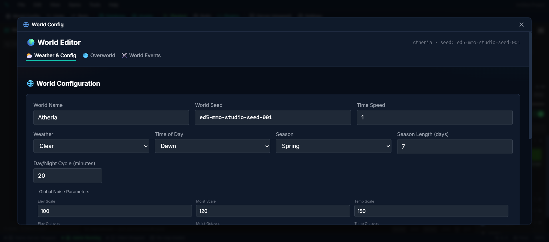
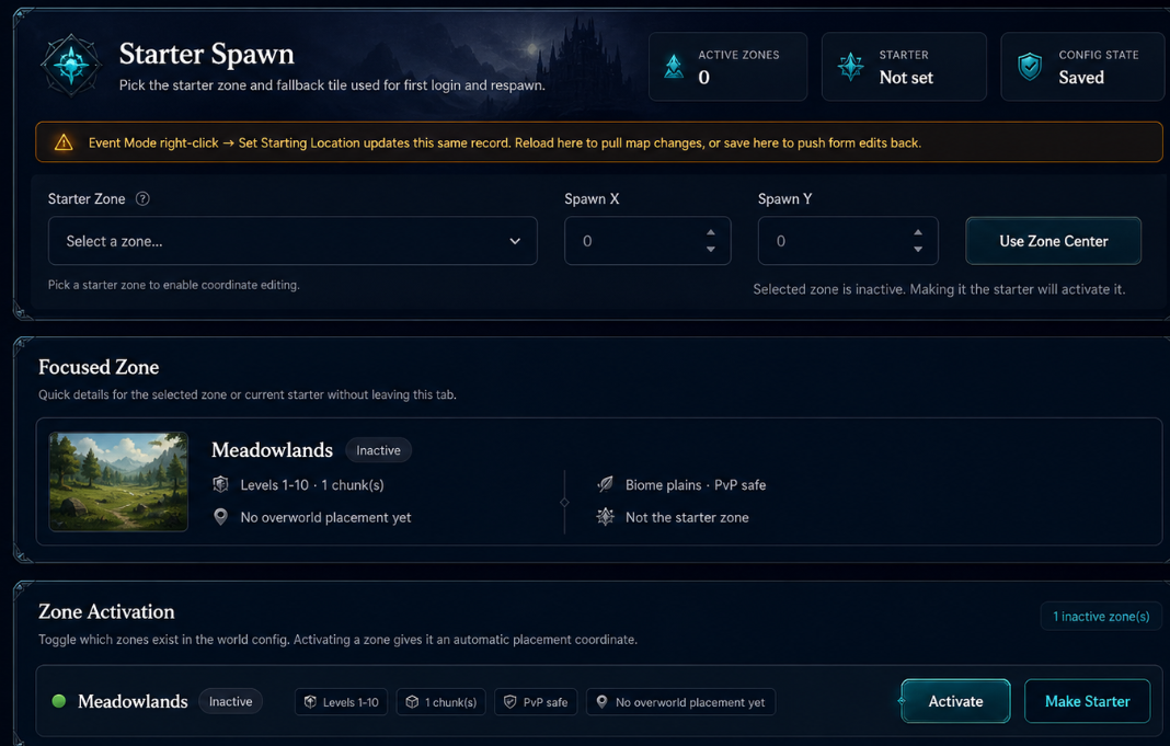
Key settings:
- Seed — a number that determines the world layout. Same seed = same world every time
- Noise parameters — control how smooth or chaotic the terrain looks
Regenerating a Zone You've Already Edited
Generation owns terrain. Everything you placed by hand is yours and survives.
Re-running Generate Zone on a zone you have worked in replaces its terrain — heights, water, tiles — and leaves your placed objects, fringe layers, tile attributes and buildings exactly where they were. You can retune the landscape under a town you have already built.
If you genuinely want a blank slate, tick Also erase my placed content in the generator before pressing Generate. That deletes the objects, fringes, attributes and buildings in the zone along with the terrain, and cannot be undone.
> Changed in this release. Generation used to erase hand-placed content every time, with no way to opt out. It no longer does.
Deterministic Generation
The same seed always produces the exact same world. This means you can share a world seed and get identical terrain — useful for consistent testing or community sharing.
Resource Node Placement
Resource nodes (trees, ore veins, herb patches, fishing spots) are placed automatically based on biome:
- Required biome — where the node spawns
- Harvest skill + level — what skill is needed to gather
- Loot table — items and quantity ranges
- Respawn timer — how long until regrowth after harvesting
Per-State Node Visuals
Resource node definitions can configure independent Full / Half / Depleted visuals using either a sprite asset or a map object definition per state. Full falls back to the default sprite; Half and Depleted inherit Full when unset. Nodes swap visuals in real time as players harvest them down.
Yield Tables and Pick Groups
Author a node's drops in Resources → (a node) → Yield Table. Each row is one possible item:
| Field | What it does |
|---|---|
| Item | What the player receives |
| Chance % | How likely this row is to drop on each harvest |
| Min – Max | How many, rolled between the two |
| Pick group | Optional. Rows that share a group name become one roll that gives exactly one of them, weighted by their chances |
Without a pick group, every row rolls on its own — a copper vein can give copper and stone from the same swing. Give rows the same pick group when a node should give one thing out of several, like an ore rock that holds iron 23% of the time, steel 16%, gold 13% and so on.
To set up a one-of table:
1. Add a row per possible item.
2. Type the same word into each row's Pick group (for example ore).
3. Set each row's Chance % to its share. Shares that add up to 100% mean every harvest gives exactly one item.
- Shares under 100% mean the group sometimes gives nothing — 20% in total gives an item one harvest in five.
- Several groups on one node each roll separately, so a node can give one ore and one gem.
- Mixing is fine: rows without a group still roll on their own beside the group.
- Needs an up-to-date game server. A server older than this feature rolls every row on its own, group or not. Managed servers pick up the new version automatically when they next restart while empty.
License Tier Gating (Studio Web)
On the hosted Studio Web environment, the following map tools require a Studio or Enterprise license tier:
- Generate Zone (procedural chunk generation)
- Add Streaming Zone (attach a streaming child zone)
localhost:3002) and Electron installs are unaffected and behave as full-tier.